
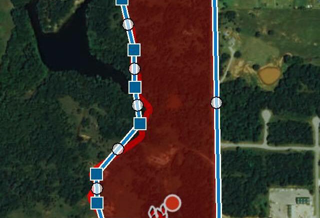

Fire officials report over 40 acres were burned up on Monday’s grass fire just south of Guthrie. A map shows the path of the fire.
The map reveals the fire originated just on the north side of Seward Road and just west of Pine St. With winds gusting over 30 mph, the fire traveled to the north.
Firefighters were able to keep the fire from jumping Pine St. and away from several homes.
“Due to the amount of hard timbers and cedar trees, access to the fire was difficult,” Woodcrest Fire Chief Luke Young told Guthrie News Page.
Related story: Fire departments battled large grass fire on the ground and in the air

Be the first to comment on "Fire officials show path of Monday’s grass fire"